

What began years ago as a grassroots idea from two residents living in historic homes has evolved into a village-wide digital showcase of Flossmoor’s architectural heritage.
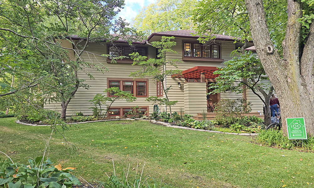
The Village of Flossmoor recently launched an interactive historic home map through its Geographic Information System platform, allowing residents and visitors to explore a curated selection of architecturally significant homes throughout the community.
Mayor Michelle Nelson said the project predates her administration and was initially sparked by residents who saw historic homes as one of the village’s strongest assets.
“It actually started before COVID,” Nelson said. “Two residents who live in historic homes wanted to see the village highlight those homes — both to attract interest and to help create a community of homeowners who could support each other in caring for aging properties thoughtfully and properly.”
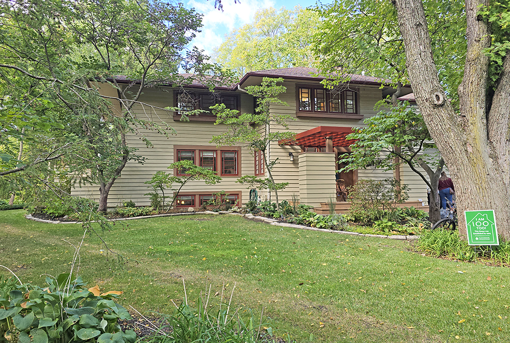
Under former Mayor Paul Braun, the village provided funding for a historic home survey. Residents photographed houses more than 50 years old that potentially held architectural significance.
The architectural firm Carlile Group was brought in to evaluate the submissions. Homes had to be at least 50 years old and represent a distinct architectural style.
“They cast a super wide net,” Nelson said. “Then they started putting homes into categories and chose the ones that best represented each style.”
Nelson later helped refine the project. She worked with residents to update and retake photographs where needed and assisted in editing the language that accompanies each listing. As a member of the local historical foundation, she also contributed personal stories about past residents connected to certain homes.
Importantly, Nelson emphasized the map is not meant to be exhaustive.
“It’s not comprehensive,” she said. “It’s representative. Just because a home isn’t listed doesn’t mean it isn’t architecturally significant. We may already have several examples of that particular style featured.”
The interactive map is accessible through the village’s broader Geographic Information System (GIS), which is also used for sidewalk inventories, tree tracking and business data. Nelson said the mapping platform makes future expansion — including potential walking tours — easy to implement.
Because many of the featured homes are within walking distance of Parker Junior High, Heather Hill Elementary and Western Avenue Elementary, Nelson sees educational potential as well.
“It could be a great tool if schools want to do a unit on architecture,” she said.
The initiative also aligns with broader economic goals. Nelson pointed to a January 2026 Crain’s Chicago Business report noting that Flossmoor was among a handful of communities that saw residential real estate prices increase in 2025 while much of the Chicagoland market remained flat.
“Yes to all of those things,” Nelson said when asked whether the project supports tourism, economic development and real estate marketing. “Highlighting homeownership opportunities and the diversity of our homes creates interest. And hopefully when people are here, they’re visiting our locally owned restaurants and small businesses.”
The map is one piece of a larger preservation effort underway in the village.
The Foundation for the Preservation of Flossmoor History is actively raising funds to restore a building at 2709 Flossmoor Road, constructed in 1889 when the street was still known as Illinois Street. The structure once housed the area’s first local grocer, predating the formal incorporation of the village.
The goal is to transform the building into a civic space that would house exhibits on local architecture and residents while also serving community organizations. The foundation also is digitizing more than 1,000 historic home appraisals that detail past owners and daily life in earlier eras of Flossmoor’s history.
“This feeds right into local preservation efforts and future preservation goals,” Nelson said.
Asked why this was the right time to launch the interactive map, Nelson offered a candid answer.
“Because we finished it,” she said with a laugh.
Village leaders balanced the project alongside public works, police and fire responsibilities. Once complete, however, officials were eager to share what Nelson described as the culmination of years of volunteer and staff work.
Looking ahead, Nelson said the initiative reflects Flossmoor’s broader identity.
“We love diversity in all forms here in our village — people, trees, businesses and homes,” she said. “This reflects those values of diversity and preservation that we like to invest in so our community continues to thrive and be a wonderful place for all of us to call home.”
Related story:
- Flossmoor History Project ramps up marketing effort based on village’s architectural treasures (April 17, 2018).