
A’s R Us Model A Ford Club, speaks at a ceremony
Thursday in Chicago marking the 100th
anniversary of Dixie Highway.
(Provided photo from Bill Hofmann)
Dixie Highway’s historic significance was commemorated Thursday at an event in downtown Chicago.
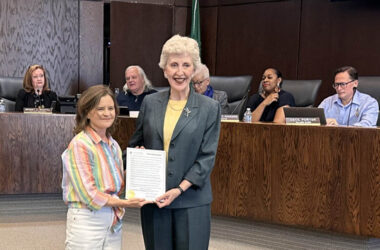
In honor of the highway’s 2015 centennial year, speakers highlighted the road’s history as the nation’s first interstate route. A model of a commemorative sign was unveiled. It will be located at Michigan Avenue and Jackson Boulevard, just a few feet from the original beginning of Dixie Highway in front of the Art Institute of Chicago.
Dixie Highway runs through Homewood, Flossmoor and other south suburbs. A similar commemorative sign was installed this summer at Independence Park in Homewood.
The event was sponsored by As Are Us Model A Ford Club as part of its Drivin’ the Dixie centennial celebration. Several members of the club are driving along the Illinois portion of the Dixie this week.
Homewood historian Jim Wright, who is treasurer of the Model A club, spoke of the highway’s importance in the development of the South Suburbs, and the hard work of the Dixie Highway Association in laying out the route and obtaining funding for improvements. Wright and Elaine Egdorf of the Homewood Historical Society displayed a mock-up of the sign showing Dixie Highway’s point of origin.
The Dixie Highway was America’s first north-south interstate highway, Wright said. On Oct. 9, 1915, a motorcade of citizens, government and highway officials set out on an inspection tour of existing roads that were identified to be improved to form the highway, he said.
Jim Garrett of the Chicago Southland Convention and Visitors Bureau was joined Thursday by two transportation officials who all spoke about the need for regional cooperation in planning the roads and highways of the future.
Dixie Highway follows Michigan Avenue south to Garfield Boulevard, then west to Western Avenue. The highway then travels south through several suburbs, including Blue Island, Homewood, Chicago Heights and Crete. It then heads south to Danville where the highway veers east into Indiana.

Commission, stands to the right of a sign
commemorating the 100th anniversary
of Dixie Highway.
(Photo provided by Bill Hofmann)